評価ツール
レイアウト評価ツール

Instruction
STEP 1. Up load a map(File format: JPG/PNG/BMP, size and transparency need to be set. No resizing if it is OSM.)
STEP 2. Click the left mouse button to add an anchor point, it can also be dragged. Set the reachable radius/color of the Anchor signal.
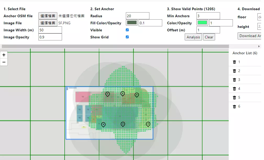
STEP 3. Set the color and distribution of the intersection, If it is green as shown in the picture below, it means that the three Anchor signals can reach the intersection area.
手順説明
STEP 1. 地図をアップロード(ファイル形式:JPG/PNG/BMP、サイズと透明度の設定が必要です。OSMの場合はサイズを調整する必要はありません)
STEP 2. マウスの左ボタンをクリックしてアンカーポイントを追加します。ドラッグすることもできます。 アンカー信号の到達可能半径/色を設定します。
STEP 3. 交差点の色と分布を設定します。下記の図の緑色は、3 つのアンカー信号が交差点エリアを示します。

